
 Translate
Flooding in the White River Watershed
Upcoming urgent flood risk reduction work on the White River
In December 2025, King County experienced an atmospheric river that was among the strongest and longest lasting storms since 1959.With funding from the King County Flood Control District, King County is repairing areas that were affected by the December 2025 flooding and is working quickly to prepare for flood season this fall.
 This includes placing temporary flood barriers to help reduce flood risk in the City of Pacific. Temporary flood barriers, sometimes referenced to by the brand name ‘HESCO,’ are useful because, once permitted, they can be installed relatively quickly and fit in a small footprint. Flood barrier placement is planned to begin in mid-to-late August along 3rd Ave SE between Skinner Road and Pacific Ave S. King County staff and contractors will continue flood barrier replacement and other repairs this summer and fall.
If you live or travel near repair areas, please expect dust, noise and periodic road closures or delays. View map of repair areas.
If you have questions, please contact River and Floodplain Management Section Manager Laura Bradstreet at lbradstreet@kingcounty.gov or 206 263-3687.
About flooding in the White River watershed
The White River watershed is an area of about 490 square miles that drains rainfall and snowmelt from smaller streams and rivers into the White River. About one-third of the watershed is in King County. The rest is in Pierce County.

The White River begins at the Emmons and Winthrop glaciers on Mount Rainier. The White River is joined by the Greenwater River and flows between the cities of Enumclaw and Buckley, then through the Muckleshoot Indian Reservation and the cities of Auburn, Algona, and Pacific. The White River continues south through the City of Sumner before joining the Puyallup River.
Flood risks in the watershed
- Most major White River floods occur from November through February.
- The lower White River landscape is relatively flat, so flooding can spread quickly across a large area.
- Scientific models show flood risks along the lower White River are likely to increase over time because of ongoing sediment deposition. When sediment is deposited in the river channel and floodplain, it makes the river channel shallower, and therefore more likely to flood.
- The cities of Pacific, Sumner, and Auburn have experienced flooding impacts from channel sedimentation.
- Pacific also experiences more frequent stormwater flooding due to the buildup of sediment in the river. Sediment buildup can cause higher river levels to back up into the city’s stormwater system.
Why is it called the White River?
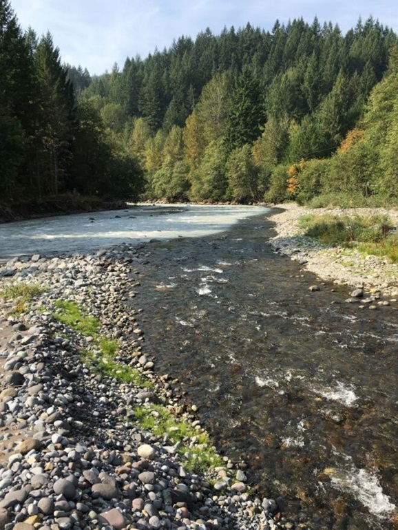
The White River is named for the color it appears during the summer, when it carries fine sediment known as glacial flour. The fine sediment comes from the grinding action of glaciers on Mount Rainier.
Flood infrastructure in the watershed
King County coordinates with the U.S. Army Corps of Engineers that owns and operates the Mud Mountain Dam. Although it is not possible to prevent all flooding, the Dam is an important part of flood risk reduction in the watershed.
The levees and revetments maintained by King County along the White River address temporary flooding on land, bank erosion, and channel migration risks. A levee is a raised structure built along a riverbank to contain, control, or divert the flow of water. A revetment is a structure built along a riverbank to reduce erosion risks.
Levees and revetments are primarily located along the lower White River in King County. The Greenwater River has two revetments. The Countyline levee maintained by King County extends into Pierce County.
The benefits of healthy floodplains
Connected, healthy floodplains can slow runoff and help store floodwater. The White River watershed also provides habitat for the last remaining population of spring-run Chinook in the south Puget Sound. Changing the natural or built environment can affect fish habitat, including water quality and temperature. We consider potential impacts to these species when designing flood risk reduction projects. Learn more about salmon in the watershed by visiting the WRIA 10 Salmon Habitat Protection and Restoration Strategy.
Resources
King County flood alerts
Sign up for White River flood alerts
Check your river gage data
A river gage station is a location where hydrologists, or people who study the flow of water, gather information such as the height, depth, and speed of a river to calculate the water flow (discharge). Some gages report both water height (or stage), whereas other gages report both stage and discharge.
- Greenwater River at Greenwater
- White River at R Street near Auburn
- White River near Auburn
- White River at Pacific
- Mud Mountain Dam discharge
Additional resources
Learn how to prepare for a flood
24/7 Sandbag Distribution in Pacific, WA
- 130 3rd Ave SE, Pacific, WA (across from Police Station)
- Directions: “Empty sandbags and sand. Self-service, limited to 25 sandbags per vehicle. Bring your own shovel.”
Want to learn more about creating a flood resilient future in your watershed?
King County and Pierce County, along with several other jurisdictions, have developed a series of flood risk reduction projects in the lower White River to address growing flood risks from ongoing sediment deposition.
The most effective strategies for reducing flood risks due to sediment deposition have been to build setback levees and install temporary flood barriers until permanent solutions can be developed and implemented.
Projects and studies
Current projects
- Pacific Right Bank Flood Protection project (located in the City of Pacific)
- 2026 flood risk reduction actions (summer/fall 2026)
- Implement urgent flood risk reduction actions in the lower White River. These actions respond to damage from the December 2025 storm. We are replacing temporary flood barriers to help reduce flood risk in the City of Pacific. Temporary flood barriers are useful because, once permitted, they can be installed relatively quickly and fit in a small footprint. King County staff and contractors will be making other repairs to infrastructure and investigate erosion and seepage problems upstream of the A-street Bridge. These activities complement the ongoing Pacific Right Bank Flood Protection Project. Please contact Laura Bradstreet, River and Floodplain Management Section Manager, with questions at lbradstreet@kingcounty.gov or 206 263-3687.
Key reports, studies, surveys
Greenwater River Channel Migration Study (King County, 2022)
Middle White River Channel Migration Zone Study and Map (2019)
Study of the Lower White River to characterize gravel accumulations and evaluate the effectiveness of gravel removal to reduce flood risks (2017)
Floodplain Mapping Study for the White River, Zone 4 (King County, 2009)
Floodplain Mapping Study for the White River, Zone 2 (King County, 2009)
Lower White River 2009 to 2016 In-Channel Sediment Monitoring, 2017 (6.39 MB)
White River Flood Inundation Maps from the U.S. Army Corps of Engineers Channel Capacity Modeling
USGS study 2019 – Coarse Sediment Dynamics in the White River Watershed
Recently completed projects
- Emergency Actions 2025-2026
- A Street HESCO Barriers Project (2023)
Stuck River Drive Repair 2020 (located in Auburn)- This project repaired damage to the rock revetment to protect Stuck River Drive and the White River Trail.
Countyline Levee Setback Project 2017 (Lower White near Auburn)
- Installation and maintenance of HESCO barriers downstream of A Street Bridge 2013 and 2016 (City of Pacific)
- This project extended and increased the height of the temporary flood barriers in 2013 to reduce flood risks for the City of Pacific. In 2016, flood barriers in White River Estates were extended to a temporary pump station at Government Canal to replace an aging sandbag berm.