Rainbow Bend Mitigation Project

Project description
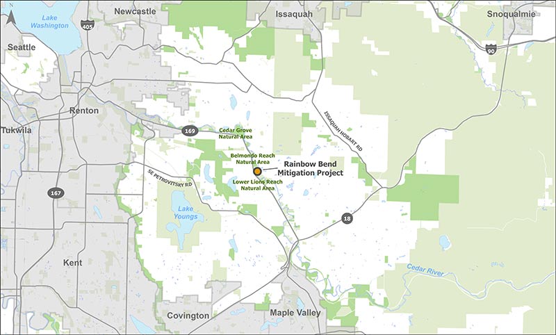
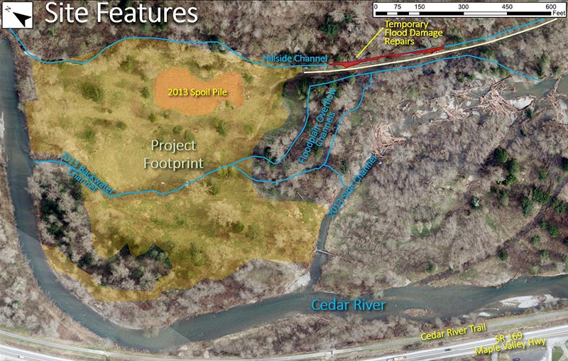
The Rainbow Bend Mitigation Project is located on a 19.78-acre portion of the Larry Phillips Natural Area at river mile 11.5 on the right (northeast) bank of the Cedar River, a short distance downstream of the Cedar Grove Road bridge. The Rainbow Bend Mitigation Project will re-establish and enhance wetland and aquatic habitat; preserve large trees; add floodplain roughness and fish and wildlife habitat through the installation of large wood and snags; and restore natural functions and processes to the Cedar River floodplain. This project adds to the successful Rainbow Bend Levee Removal and Floodplain Reconnection Project that was constructed in 2013. Construction begins in 2023 and the completed project will create 5.89 acres of new, primarily forested, wetland while preserving large trees and enhancing existing upland areas. It will also create new floodplain channels and enhance existing channels. The Rainbow Bend Mitigation Project will compensate for unavoidable permitted impacts to wetlands and aquatic resources in the Cedar River/Lake Washington Service Area.
Vicinity map

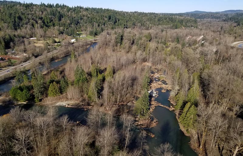
Pre-construction aerial

Background
The Cedar River has been altered by dam operations, levees and revetments that confine the river to a single channel and other land use activities that have degraded wetland and floodplain habitat in and around the Cedar River. These changes have resulted in reduced quantity and quality of habitat for fish and wildlife. This project is intended to restore wetland habitat in the Cedar River floodplain while encouraging natural processes that will change the site over time. The Rainbow Bend Mitigation Project will also provide mitigation credits for King County’s Mitigation Reserves Program.
This project reach was identified as a high priority area for habitat restoration in the WRIA 8 Chinook Salmon Conservation Plan. Several projects have been implemented in this reach to restore river and floodplain functions. This project ties elements of the 2013 Rainbow Bend Levee Removal and Floodplain Reconnection Project together and is consistent with and complimentary to the project.
Project design
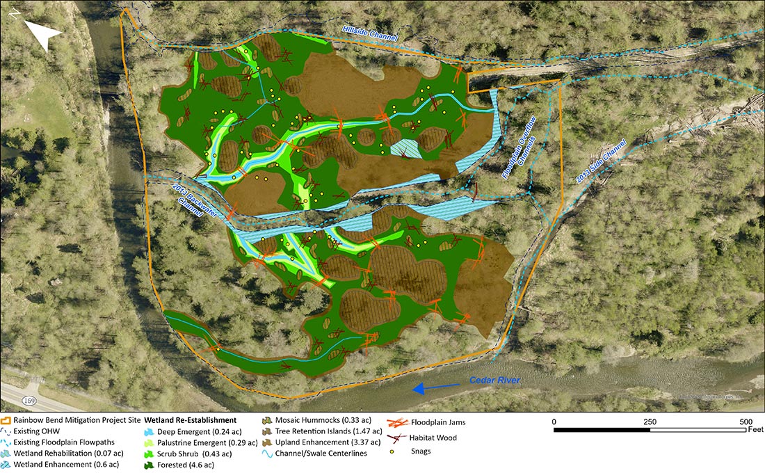
The Rainbow Bend Mitigation Project will re-establish and enhance wetland and riparian habitat and encourage natural processes by removing fill material and re-grading the site to create more natural topography, installing large and small habitat logs and rootwads and planting native vegetation. This project offers an opportunity to add to a highly successful restoration project. The Rainbow Bend Mitigation Project will re-establish and enhance wetland and aquatic habitat; preserve large trees; add floodplain roughness and aquatic and terrestrial habitat through the installation of large wood and snags; and restore natural functions and processes of the Cedar River floodplain. Specific project features include 0.6 acre of wetland enhancement, 5.96 acres of wetland re-establishment and rehabilitation, 1.47 acres of tree retention, and 3.37 acres of upland enhancement. The project will also incorporate snags, large wood clusters, and small wood piles. The focus on forested wetland habitat surrounded by upland enhancement will preserve mature trees and help maintain seed sources for conifer trees in this reach of the Cedar River.

Project schedule
|
Rainbow Bend Mitigation Project schedule overview |
|
|---|---|
|
Alternatives analysis |
December 2021 |
|
30% design plans |
September 2022 |
|
60% design plans |
December 2022 |
|
90% design plans |
February 2023 |
|
Implementation |
Summer/Fall 2023 |
|
Monitoring |
2024 - 2033 |
 Translate